Blog
10 Next-Gen Technologies for Predicting Weather

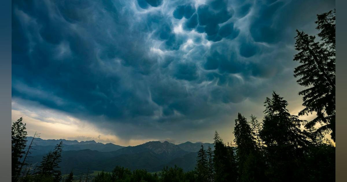
Weather forecasting has come a long way from relying solely on weather balloons, satellites, radar, and numerical prediction models. Today, AI, advanced radar systems, and new satellite technologies help meteorologists better understand atmospheric conditions, improve forecast accuracy, and provide earlier warnings for hazardous weather. In this roundup, we look at 10 technologies driving the next generation of weather forecasting.
ESA (European Space Agency) and JAXA (Japan Aerospace Exploration Agency) have developed a satellite capable of analyzing vertical cloud structures from space, providing a new avenue for predicting the weather. The EarthCARE (Earth Clouds, Aerosols and Radiation Explorer) satellite is now being integrated into ECMWF’s (European Centre for Medium-Range Weather Forecasts) global forecasting system, which is the first time any forecasting center has utilized the unique form of data.
The satellite’s CPR (Cloud Profiling Radar) provides detailed profiles of vertical cloud structure and precipitation intensity. ECMWF then uses EarthCARE’s radar reflectivity data, along with millions of other observations, to forecast the weather.
NOAA HRRRCast Version 3
NOAA’s (National Oceanic and Atmospheric Administration) HRRRCast Version 3 (High Resolution Rapid Refresh) is the latest version of its experimental, AI-powered regional forecasting system. HRRRCast is described as a data-driven model trained on three years of HRRR model data, for testing by NOAA’s National Weather Service, which has been NWS’s short-term forecast model for the last 10 years.
The March 2026 release provides new capabilities, including increasing its resolution to 3 km, a larger training set increase from three years to nine, new diagnostic variables (including wind shear and helicity), and new Neural Network Variable Predictions (low, mid, and high cloud cover variables).
NOAA Mobile Weather Radar Fleet
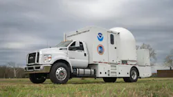
NOAA also has a new mobile weather radar fleet that it states will deploy research-grade technology to the front lines of tornadoes, wildfires, hailstorms, flash flooding and severe wind events. The fleet will provide the agency with new insight into hazardous weather threats in real-time.
Each truck is equipped with an X-band (3-cm-wavelength) radar unit, with only one carrying a C-band (5-cm-wavelength) radar. The shorter-wavelength X-band radars are more sensitive and can see smaller drops and particles with increased efficiency at the expense of imaging large drops or dense concentrations of drops, which could cause data quality issues.
Robin PHARA Phased-Array Weather Radar
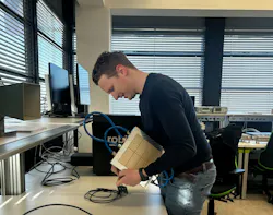
Robin Radar Systems’ PHARA phased-array weather platform is a 3D radar designed to track the movement and growth process of cloud particles and large-scale weather fronts. The new platform will allow meteorologists to get a better understanding of extreme weather faster than traditional radar. To put that into perspective, traditional radar can take up to five minutes to scan the sky, while a TX and RX panel array can do the same job in under a minute.
Robin successfully developed the first prototype TX tile in a 14-tile array that will ultimately form the complete transmit phased-array antenna of PHARA (PHased Array Radar for Atmospheric research), a fast-scanning phased-array radar in Ku-band with polarization diversity.
NOAA Artificial Intelligence Global Forecast System (AIGFS)

NOAA has also taken advantage of a new AI suite for weather forecasting with its latest global weather prediction models, which are designed to increase speed, accuracy, and efficiency. The new suite includes three different models. This includes AIGFS (Artificial Intelligence Global Forecast System), a weather forecast model that tasks AI to deliver improved weather forecasts more quickly and efficiently.
Also in the mix are AIGEFS (Artificial Intelligence Global Ensemble Forecast System), an AI-based ensemble system that produces a range of probable forecast outcomes, and HGEFS (Hybrid-GEFS), a hybrid “grand ensemble” that combines AIGEFS with NOAA’s Global Ensemble Forecast System. The agency states it consistently outperforms both the AI-only and physics-only ensemble systems.
Destination Earth (DestinE)
The European Commission’s Destination Earth (DestinE) is in its third phase in efforts to create accurate digital twins of Earth’s system for climate-change adaptation and weather-induced extreme events. Instead of producing traditional weather forecasts, DestinE creates a digital twin of Earth that it can use to simulate different weather and climate scenarios at a highly scaled resolution.
The platform combines satellite observations from ESA and EUMETSAT with ECMWF forecasting models and European supercomputers to model extreme weather events. In turn, meteorologists can run “what-if” events that include floods, hurricanes, heatwaves, and storms.
Tomorrow.io’s ICGen
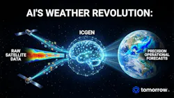
Tomorrow.io’s ICGen project looks to use AI to convert satellite imagery into better weather forecasts; in this case, numerical weather prediction (NWP) systems. The initiative employs a growing constellation of microwave sounder satellites to collect a wealth of weather data, including temperature and humidity profiles, even in cloudy conditions.
Instead of using massive computational resources to process all of that data, engineers employ machine-learning algorithms to generate improved atmospheric initial conditions, which can then be integrated into existing forecasting models.
Meteomatics EURO1k Weather Model
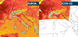
Swiss weather company Meteomatics expanded its EURO1K forecasting model, which generates weather forecasts down to 1-km resolution across Europe. Incorporating NASA’s digital terrain model and Meteomatic’s Meteodrones that collect low-altitude atmospheric data, the resolution is further scaled down to 90 meters, providing hyperlocal forecasts for specified landscapes. What’s more, the EURO1K model is also able to capture micro-weather phenomena, such as sudden thunderstorms, hail, fog, and local wind channeling, which is the same no matter the country.
EUMETSAT Meteosat Third Generation (MTG)
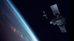
The Meteosat Third Generation geostationary meteorological satellite system developed by EUMETSAT is designed to forecast severe weather conditions. The constellation, four imagers and two sounders, can generate up to 50X more data than traditional satellites and scan a full Earth face every 10 minutes or target smaller regions, such as Europe, in just 2.5 minutes.
The platform is outfitted with lightning imagers that provide constant day-and-night surveillance of both cloud-to-cloud and cloud-to-ground lightning flashes, infrared sounders that map the atmosphere’s temperature and humidity, and ultraviolet, visible, and near-infrared spectrometers mounted on the sounding satellites that monitor trace gases and air quality.
WindBorne WeatherMesh AI Forecasting Platform
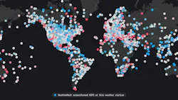
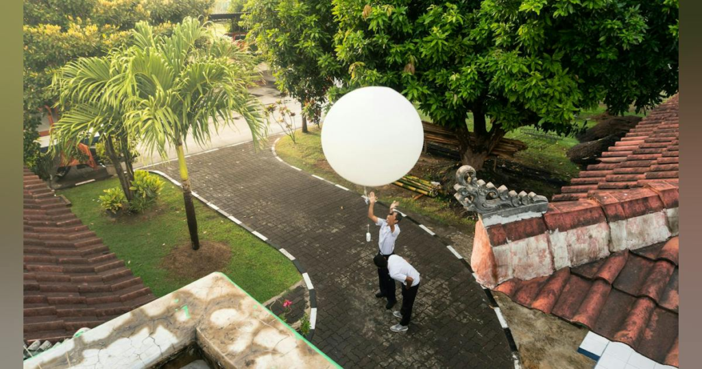
WindBorne’s WeatherMesh AI Forecasting platform is another AI-based system designed for global weather forecasting, combining deep learning and next-gen sounding weather balloon technology.
Unlike traditional radiosondes, the company’s WeatherMesh balloons can remain airborne for days or even weeks, collecting atmospheric data such as pressure, temperature, humidity, and wind measurements from the world’s oceans and remote regions. The gathered data is then assimilated into the WeatherMesh weather model that can generate forecasts within seconds, rather than hours.
Final Thought
As weather forecasting technology continues to evolve, meteorologists are gaining access to faster models, better observations, and more detailed atmospheric data than ever before. While forecasting will always involve some level of uncertainty, these technologies are helping improve accuracy and provide earlier warnings for everything from severe thunderstorms to hurricanes and flash flooding.